
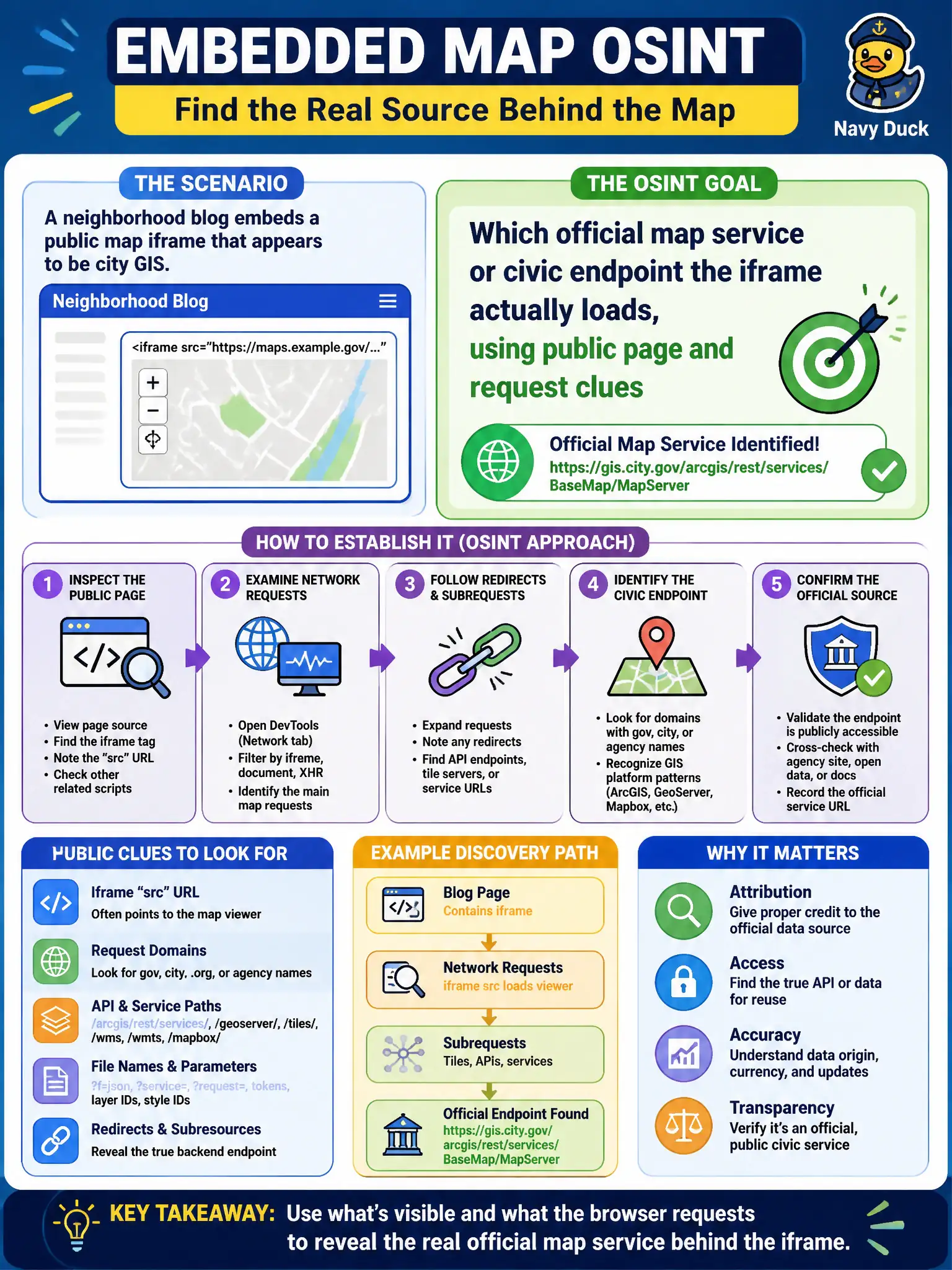
A neighborhood blog embeds a public map iframe that appears to be city GIS. What should website OSINT establish?
Select an answer to reveal the explanation.
Short Explanation
An iframe is a window in someone else's wall — look through it to see whose map is actually showing. Public page source and request URLs identify the civic GIS or map API behind the blog. The iframe does not hire the blogger or authorize an attack.
Full Explanation
When a neighborhood blog embeds a public map iframe that appears to be city GIS, website OSINT should establish which official map service or civic endpoint the iframe actually loads, using public page and request clues. Iframes are windows onto someone else’s map stack. Concluding the blog owner is a city employee because an iframe is present fails; embedding public maps is common and does not prove employment. Obtaining admin credentials for GIS by attacking the embedded frame fails as unauthorized access. Claiming third-party pages cannot embed civic maps so the iframe must be ignored fails; embeds are routinely allowed and still worth identifying. Exam caveat: identifying the endpoint supports authenticity and terms-of-use questions without attacking GIS. Operational check: inspect public page source and network request URLs for the map service; name the civic or vendor endpoint in notes; avoid attacking the frame. In municipal practice, record the rationale in the case file so future staff know which control was chosen and which failure modes the rejected options would create for city services. Re-validate the finding against current public sources before the next procurement or communications decision.