
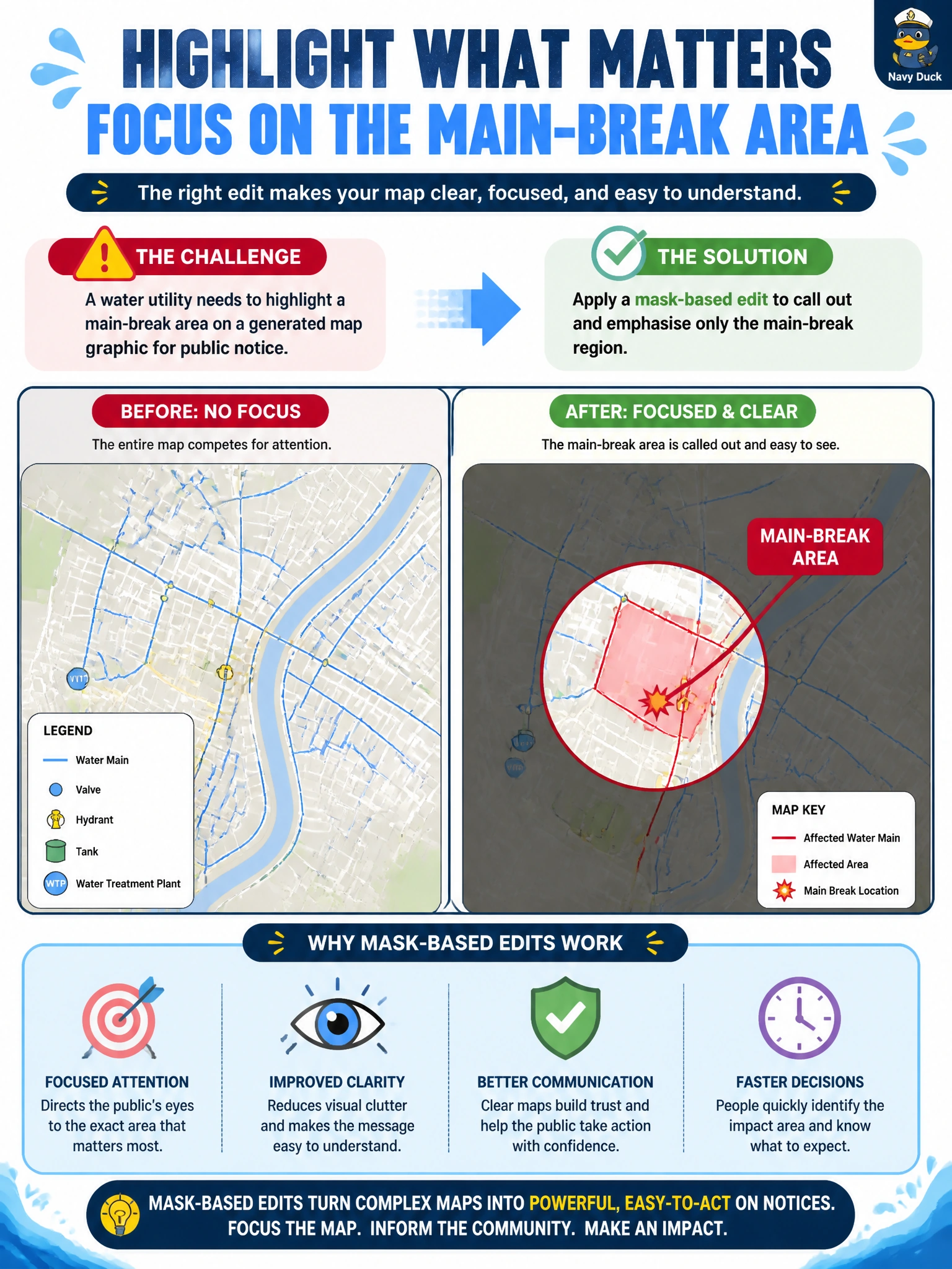
A water utility needs to highlight a main-break area on a generated map graphic for public notice. Which editing approach should they apply?
Select an answer to reveal the explanation.
Short Explanation
A mask is a spotlight for the break zone—paint the region, regenerate or emphasize just that patch, leave the rest of the map alone. That is how water utility notices call out a main break. A stylistic filter restyles it, a GIS-based regeneration can invent streets, and a super-resolution upscale just sharpens pixels, so you'll still struggle to find a clear, trustworthy outage callout.
Full Explanation
Mask-based image editing lets communicators select a region of a generated graphic and regenerate or emphasize only that area. For a water utility public notice, applying a mask over the main-break zone on a map graphic is the right approach: the surrounding street context stays intact for orientation, while the masked region receives a callout, highlight, or corrected detail that draws attention to the outage area. Residents then see where the break is without the utility redrawing the entire basemap from scratch.
Applying a stylistic filter to call out and emphasize only the main-break region misses the notice’s purpose; it restyles colors and textures across that patch instead of adding a precise masked highlight, so residents see an artistic change but still cannot quickly recognize authoritative streets and the outage location. Applying a GIS-based regeneration to call out and emphasize only the main-break region fails because it rebuilds map content inside the patch rather than preserving the basemap with a clear highlight, and the regeneration can invent streets or labels that conflict with the utility’s authoritative GIS. Applying a super-resolution upscale to call out and emphasize only the main-break region fails because it only increases pixel sharpness and detail without adding a visual highlight, so the callout requirement is never met even though those pixels look crisper.
Exam caveat: mask edits are regional—outside the mask should remain stable. Even a GIS-based regeneration to call out and emphasize only the masked region can invent streets that do not match the utility’s GIS. Operational check: align the masked highlight to the authoritative main-break coordinates, verify street labels remain readable, confirm the notice text and map agree on the same block, and retain the pre-edit asset for records.
Prefer to study offline? Printable PDF study book + test engine ($7.50, unofficial). These questions stay free here.