
Public works forecasts digital twins of storm drains that combine sensors and predictive models. What advanced direction is that concept describing at a literacy level?
Select an answer to reveal the explanation.
Short Explanation
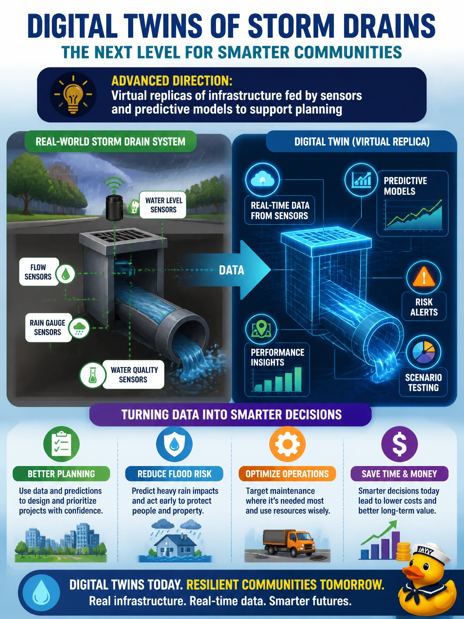
Think of a digital twin as a living video-game copy of the storm drains—sensors feed it, models forecast trouble. You’re hearing public works describe that advanced civic direction in plain literacy terms. Virtual twin, real planning value.
Full Explanation
Public works forecasting digital twins of storm drains that combine sensors and predictive models is describing, at a literacy level, virtual replicas of physical infrastructure that are fed by telemetry and coupled to models so planners can test what-if storms, prioritize maintenance, and rehearse flood response. A twin is not a static map poster; it is an operational mirror that updates from sensor reality and supports predictive planning for drains, outfalls, and related assets under municipal responsibility. High-fidelity 3D CAD models combined with sensors and predictive models to design upgrades still miss the planning purpose a digital twin needs to serve, because designing upgrades uses detailed geometry for engineering design rather than providing a sensor-fed virtual replica to support planning. Real-time GIS dashboards integrated with sensors and predictive models to alert on anomalies confuse an anomaly-alert display with the virtual replica underneath it, and they lack the what-if planning a twin needs. Automated dispatch systems driven by sensors and predictive models to assign repair crews are a dispatch output that could use twin data, not the sensor-fed virtual replica itself, so they are crew-tasking tools, not twins. Exam caveat: digital-twin items map to sensor-fed virtual replicas plus predictive models for planning—not upgrade-design CAD models or anomaly-alert displays or repair-crew dispatch systems for engineering systems. Operational check: define which drain segments and attributes belong in the twin; calibrate expectations for sensor latency and missing tags; validate model forecasts against known storm hydrographs; keep licensed engineers as decision owners when the twin recommends capital projects or emergency interventions; and document uncertainty so twin outputs inform—not silently dictate—public works action.
Prefer to study offline? Printable PDF study book + test engine ($7.50, unofficial). These questions stay free here.